

Key Information Is Provided Along Metro's Silver Line in Tysons and Reston
Data analytics and digital mapping are pivotal in the commercial real estate sector, offering a transformative approach to property management, market analysis and investment decisions. By harnessing the power of data analytics, stakeholders can uncover valuable insights into market trends, consumer behavior and investment risks, enabling more informed and strategic decision-making. Digital mapping, on the other hand, provides a visual representation of data, allowing for the geographical visualization of market dynamics, property valuations and demographic information. Together, these tools empower commercial real estate professionals to optimize portfolio performance, enhance tenant satisfaction and drive economic growth. In an industry where precision and foresight are key, data analytics and digital mapping are not just advantageous – they are essential.
Understanding the importance of aggregating and providing transparency of key metrics, Fairfax County, Virginia, has released two interactive data and analysis platforms covering Tysons and Reston along seven of the Silverline Metro Stations. In addition, the Tysons Community Alliance, in partnership with Fairfax County, released its Tysons Data Hub, which compliments the Tysons Tracker by providing residents, business owners, investor, developers and others a comprehensive understanding of Tysons' current development, demographic and market landscape.
Tysons Tracker
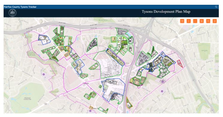
Image courtesy of Fairfax County
The Tysons Tracker interactive data platform provides data and analysis on the following topics with respect to monitoring the implementation of the Comprehensive Plan for Tysons:
|
|
Tysons Data Hub
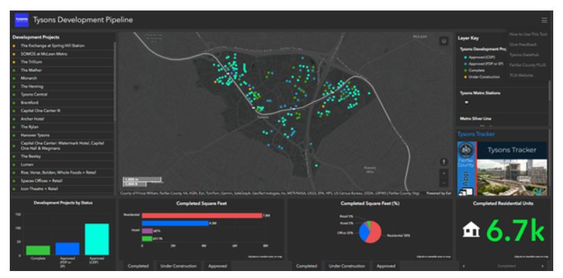
Image courtesy of Tysons Community Alliance
The Tysons Community Alliance's Data Hub is a game-changing data platform prepared in partnership with Fairfax County. It provides helpful insights on the following topics:
- Tysons Overview
-
- economy
- demographics
- workforce
- Tysons Market
-
- office
- residential
- retail
- hospitality
- Transportation
-
- details ranging from metro ridership, walk score, jobs within one-quarter of a mile of the metro and commute mode shares
- Tysons Development Pipeline
-
- a comprehensive tool providing many layers and toggles to ascertain market and inventory data
Reston Snapshots
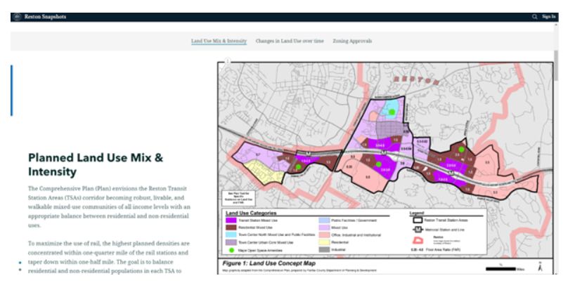
Image courtesy of Fairfax County
This interactive Reston Snapshots mapping data platform provides insight into the Reston Transit Station areas and is divided into four primary areas of focus:
- Transportation Hub. Zoom into the bustling activity of traffic, transit, pedestrians and cyclists and discover the latest improvements shaping the future of mobility.
- Land Use Hub. Uncover the potential of current land use, witness the growth of new developments and see how the vision of the Comprehensive Plan comes to life.
- Urban Parks Hub. Explore the green heart of the city, where urban parks and athletic fields bloom amidst the concrete jungle.
- Zoning Activity Hub. Navigate through the maze of zoning applications, track their progress and stay ahead of the curve with real-time updates.
With regular updates and a collaborative spirit, these digital mapping platforms are a testament to the dedication of Fairfax County and the Tysons Community Alliance to creating a thriving urban environment along the Silver Line's metro station areas.
For more information on redevelopment in Fairfax County, contact Holland & Knight's Mid-Atlantic Land Use Team.
The content of this article is intended to provide a general guide to the subject matter. Specialist advice should be sought about your specific circumstances.